Horticulture Mapping Robot
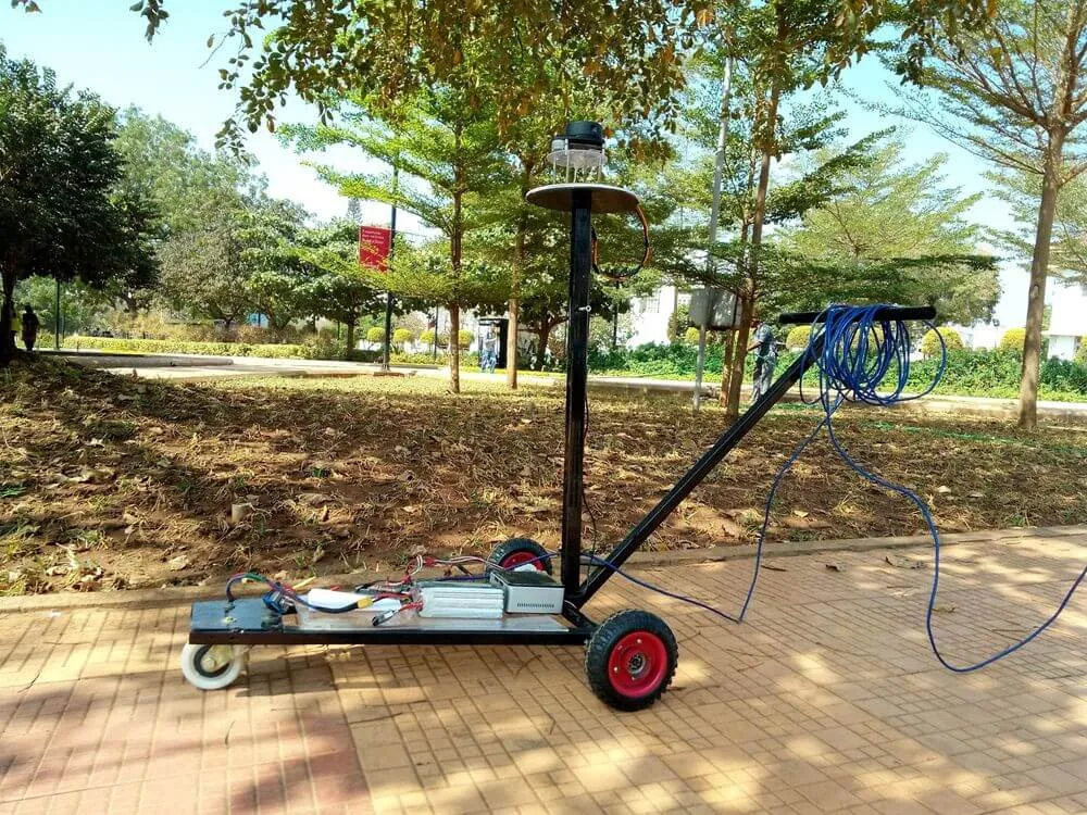
Handheld robot to measure foliage and/or count trees in horticulture fields using a 2D LiDAR, IMU, and odometry (wheel or visual odometry for use untethered from the ground). It can be mounted on any agricultural machinery or on a hand-cart, as shown below.
As shown in the application interface below, RViz is used for displaying the LiDAR scan data, mapping data, and detected tree trunks in the bottom-left corner.
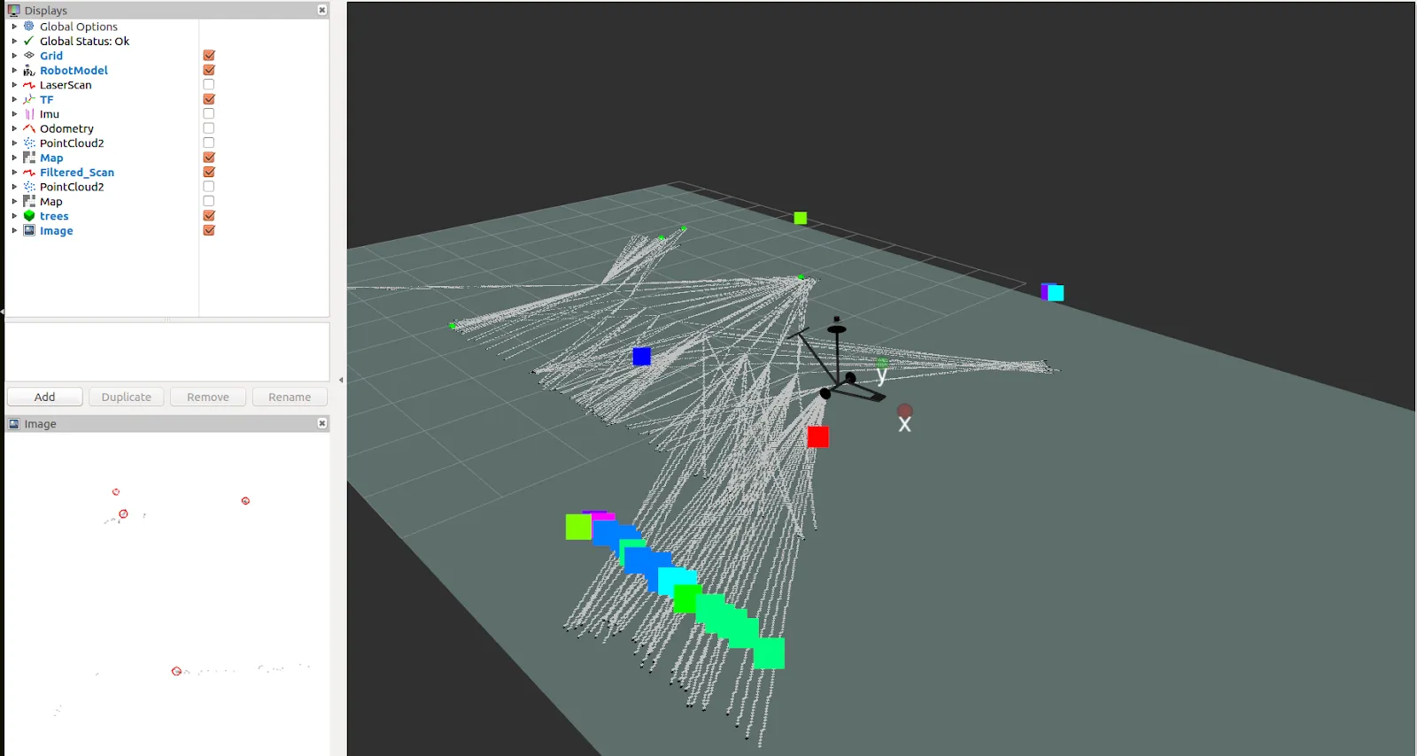 Main window: 2D LiDAR scan; bottom-left window: tree trunks
OpenCV is used to detect tree trunks via SimpleBlobDetector, which extracts blobs by circularity and area.
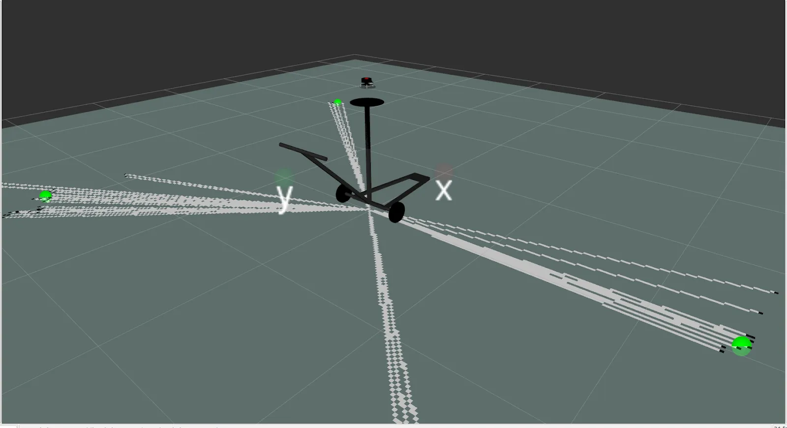 Detected tree trunks shown as green spheres
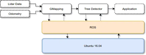 Software architecture
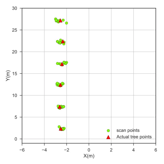 Graphed tree trunk positions, verified with a professional laser measuring tool